One of Conservation Halton’s (CH) top priorities is to protect life and property from natural hazards and updating hazard mapping is one of the ways they do that.
East Burlington Creeks Flood Hazard Mapping
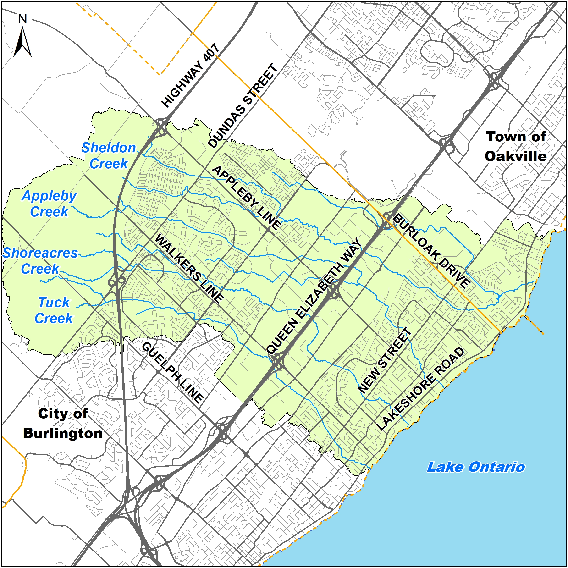
CH is currently updating flood hazard mapping for Tuck, Shoreacres, Appleby, and Sheldon Creeks that cross through parts of East Burlington and southwest Oakville.
Flood hazard mapping is an important tool that supports CH’s regulatory, planning and flood forecasting and warning programs, as well as municipal emergency management, flood mitigation, and infrastructure design. “Flood hazard” means an area near a river or stream not ordinarily covered by water that is flooded during extreme storm events.
Virtual Public Engagement #2
In October 2021, CH hosted a public engagement session to notify property owners, residents, and other stakeholders of the study and provide them an opportunity to ask questions and share feedback.
Attend the upcoming session to learn more about CH’s East Burlington Creeks Flood Hazard Mapping Study and updated draft flood hazard mapping and ask your questions.
- June 6, 2023
- 7 p.m. start
- Online via Zoom
- Register for your link at https://us02web.zoom.us/webinar/register/WN_sl19iHNURcerow1W3mK8PQ
What’s next?
After the public engagement session on June 6, 2023 and 30-day public review period to July 6, 2023, CH will review all feedback received and make any necessary revisions to the draft flood hazard mapping. It is anticipated that the final draft mapping and study will be presented to CH’s Board of Directors for their approval and inclusion in CH’s online Approximate Regulation Limit (ARL) mapping later this year.
For more information
To review the draft mapping and reports, the recording of the public engagement session, and/or provide your comments (until July 6, 2023), please visit https://www.conservationhalton.ca/mapping-and-studies/ and click on “East Burlington Creeks Flood Hazard Mapping Study.”
For any questions about the study or upcoming Public Engagement Session #2, please contact CH staff by email at floodplainmapping@hrca.on.ca or call (905) 336-1158 ext. 2296.
Connection to Climate Resilient Burlington (CRB): A Plan for Adapting to Our Warmer, Wetter and Wilder Weather
Flood Management is one of the action areas under the theme of Resilient Built and Natural Infrastructure in the CRB plan. Having up to date information such as flood hazard mapping will help us work towards the goal: ‘Enhance resilience of infrastructure exposed to high flood risk.’
Take Action Burlington! Get informed as a first step to getting prepared for our warmer, wetter and wilder weather. Collectively, we can make a difference.
